How GPS Knows Exactly Where You Are
Jasiah Alvarez
September 1, 2026
Open a map on your phone and a small blue dot appears, often showing your location within just a few meters. Start walking and the dot follows you. Get into a car and your phone can calculate your speed, direction and estimated arrival time.
It feels as though your phone is somehow announcing its location to satellites in space.
Surprisingly, that is not how GPS normally works.
Your phone primarily listens.
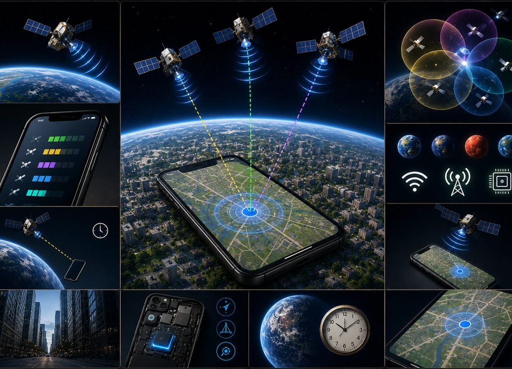
Satellites orbiting thousands of kilometers above Earth continuously transmit signals containing extremely precise timing and positioning information. Your phone receives signals from several of them and calculates how far away each satellite is.
From those distances, it can work out where you are.
GPS relies on satellites orbiting Earth
GPS stands for Global Positioning System.
The system uses a constellation of satellites orbiting Earth. These satellites continuously transmit radio signals that devices on the ground can receive.
Each signal contains important information, including where the satellite is and when the signal was transmitted.
Timing is crucial because radio signals travel at approximately the speed of light.
Your phone can compare when a signal was sent with when it arrived. That tiny difference allows the device to estimate how far the signal traveled.
If the signal took longer to arrive, the satellite is farther away. If it arrived sooner, it is closer.
Your phone repeats this process using several satellites.
That is where your location begins to emerge.
One satellite is not enough
Knowing your distance from one satellite does not reveal exactly where you are.
Imagine someone tells you that you are exactly five kilometers from a particular building.
That information narrows down your location, but you could still be anywhere around the building at that distance.
Now imagine knowing your distance from several different landmarks.
The possible locations begin to overlap until only one position makes sense.
Satellite navigation works on a similar principle.
By measuring its distance from multiple satellites whose positions are known, your device can calculate its own location.
This process is commonly explained using the idea of trilateration.
It is about measuring distances rather than simply asking a satellite to point toward you.
Your phone needs several satellite signals
For a useful position, a GPS receiver generally needs signals from at least four satellites.
Three help determine your position in three-dimensional space, while another helps correct for timing differences in the receiver’s clock.
This timing correction matters enormously.
GPS calculations depend on extremely tiny differences in signal arrival times. Even a small clock error could create a substantial error in the calculated distance.
Satellites carry extremely accurate atomic clocks.
Your smartphone obviously does not.
Using signals from additional satellites allows the receiver to solve for its position while also correcting its own timing error.
In practice, your phone may receive signals from many satellites at once, helping improve accuracy and reliability.
Your phone is not usually sending a signal to GPS satellites
This is one of the biggest misconceptions about GPS.
When your phone determines its position using GPS, it does not normally need to ask a satellite, “Where am I?”
The satellites broadcast signals continuously.
Your phone receives them and performs the calculation itself.
That means basic GPS positioning can work without a mobile data connection.
This is why a dedicated GPS device can determine its location in areas without cellular coverage.
However, your phone’s map may still need internet access to download map information, traffic data or search results.
Knowing your coordinates and displaying a detailed map around those coordinates are separate tasks.
Phones use more than GPS to find you
Although people often call all phone navigation “GPS,” modern smartphones can use several positioning systems and technologies together.
GPS is operated by the United States, but other global satellite navigation systems exist, including Europe’s Galileo, China’s BeiDou and Russia’s GLONASS.
Modern phones can often receive signals from multiple systems.
Your device can also use nearby Wi-Fi networks, cellular towers and sensors to help determine or refine your location.
This is particularly useful in cities and indoors, where satellite signals may be blocked or reflected by buildings.
Your phone may therefore combine several clues rather than depending entirely on one technology.
The blue dot on your map is often the result of multiple positioning systems cooperating.
Buildings can make GPS less accurate
Satellite navigation works best when the receiver has a relatively clear view of the sky.
Tall buildings, mountains, roofs and other obstacles can interfere with signals.
Cities create a particular challenge.
Signals can bounce off buildings before reaching your phone. The device may then interpret the longer path as though the satellite were farther away than it really is.
This is known as a multipath effect.
It helps explain why your location can occasionally jump to the wrong side of a street or appear inside a nearby building.
Indoors, the problem becomes even greater because satellite signals are relatively weak by the time they reach Earth’s surface.
That is why phones rely heavily on additional location technologies in some environments.
Your phone also needs to know which direction you are facing
Knowing where you are and knowing which way you are facing are different problems.
GPS can help determine your direction when you are moving because the device can compare your position over time.
When you are standing still, phones can use other sensors.
A magnetometer acts somewhat like a digital compass. Accelerometers detect movement, while gyroscopes help measure rotation.
Combining this information allows navigation apps to provide a much more natural experience.
The map can rotate as you turn, estimate how you are moving and continue tracking movement even when satellite information briefly becomes less reliable.
This combination of satellite signals and local sensors is one reason modern navigation feels so responsive.
GPS also has to account for relativity
One of the strangest parts of GPS is that Einstein’s theories of relativity matter to something as ordinary as checking directions to a restaurant.
The clocks aboard GPS satellites do not experience time at exactly the same rate as clocks on Earth’s surface.
Their high speed affects time according to special relativity, while the weaker gravity they experience in orbit affects it according to general relativity.
These effects are tiny in everyday terms.
For GPS, tiny timing differences matter enormously.
The system has to account for them so positioning calculations remain accurate.
Without the necessary corrections, location errors would accumulate rapidly.
Your phone’s blue dot therefore depends partly on physics that once seemed almost impossibly theoretical.
GPS is really an extremely precise clock system
GPS is often described as a location technology, but underneath it is an extraordinary system for measuring time.
Satellites broadcast precisely timed signals. Your device measures how long those signals took to reach it. From that timing, it estimates distances. From several distances, it calculates a position.
Then maps and other software turn those coordinates into something useful.
The result feels almost effortless.
You open your phone and immediately see where you are.
Behind that blue dot are satellites moving through space, atomic clocks measuring extraordinarily small fractions of a second, radio signals traveling at the speed of light and mathematical calculations happening inside the device in your hand.
GPS does not need to watch you from space.
It simply tells your phone exactly where the satellites are.
Your phone figures out the rest.